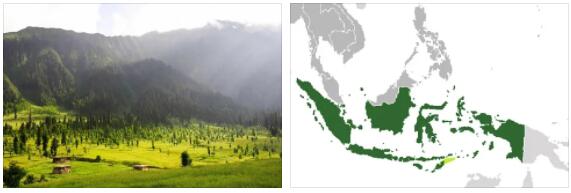
Indonesia is an archipelago located at the equator and consists of more than 13,000 islands. The country is located between the Indian Ocean and the Pacific Ocean in Southeast Asia. Indonesia’s largest islands are Sumatra, Java, Kalimantan which is also called Indonesian Borneo, Sulawesi and the Indonesian part of New Guinea which is also called Papua or Irian Jaya. In terms of population, Indonesia is ranked as the world’s fourth most populous country and here are the vast majority of Muslims. The country is divided into islands and most cities are found in Java where over half of the country’s population lives. This is an island that has a size comparable to the state of New York in the United States.
The capital of Indonesia is called Jakarta and is located in Java. Jakarta is home to more than 14 million people and the city has long been ranked among the world’s nine largest cities.
Geography and climate
The Indonesian islands have mountainous terrain and dense rainforest. There are also active volcanoes here. Many of the smaller islands belong to archipelagos such as the Moluccas, formerly known as the Spice Islands. Most of the islands are uninhabited and they are located on both sides of the equator. Indonesia borders Malaysia, Borneo, Papa New Guinea on New Guinea, East Timor on the island of Timor, Singapore, the Philippines, Palau and Australia. The country’s highest point is Puncak Jaya’s peak at 4,884 meters. This mountain peak is located on the island of Papua. The largest lake is Lake Toba which is located on Sumatra. Important Indonesian rivers are Mahakam and Barito which are both on the Kalimantan. These rivers serve as important transport routes between the island’s various communities.
According to Bridgat, The climate is tropical and the warm water ensures that the land temperatures also maintain a constant warm level. At the coasts, the average temperature is around 28 ° C, while the hinterland has an average of around 26 ° C and mountain regions 23 ° C as the average temperature. Since it is located right by the equator, the length of the day is largely the same all year round. What gives differences in terms of weather and climate is the rainfall. Between June and September, monsoons blow in from the south and east.
A land of volcanoes
As Indonesia is located along the edge of the Pacific Ocean, the Eurasia Plateau and the Australian Continental Plateau, this is a country with great volcanic activity. It is estimated that there are at least 150 active volcanoes in the country and here Krakatoa and Tambora are known names of volcanoes that have had eruptions with devastating consequences. The seismic activity also leads to tsunami waves. The 2004 tsunami killed about 168,000 people in Sumatra. Now the volcanic activity is not just something negative. The ash that comes from the volcanoes makes the soil on the islands very fertile, which is good for local agriculture.