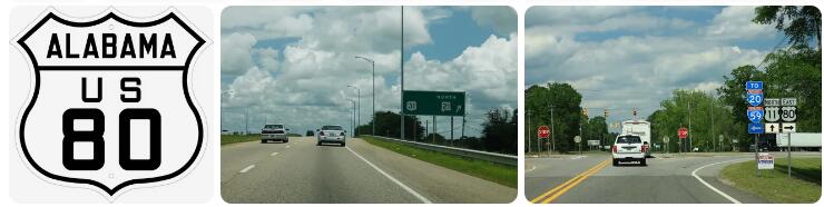
| US 80 | |
| Get started | Cuba |
| End | Phenix City |
| Length | 219 mi |
| Length | 352 km |
According to existingcountries.com, US 80 is a US Highway in the US state of Alabama. The road forms an east-west route through the center of the state, from the Mississippi border at Cuba, through the capital Montgomery, to the Georgia border at Phenix City. In particular, the section between Cuba and Montgomery is a major thoroughfare with generally 2 lanes in each direction. The road bears the administrative number SR-8 and is 352 kilometers long.
Travel directions
Cuba – Montgomery
The Selma to Montgomery National Historic Trail.
US 80 in Mississippi comes from Meridian and reaches the state line between Mississippi and Alabama at the village of Cuba. US 80 is briefly double-numbered with US 11 and then splits off to become a 2×2 divided highway through rural central Alabama. The first part between Cuba and Demopolis leads through densely forested area and has a bridge over the Tombigbee River. There are no real built-up areas on this route, the US 80 functions here as a single-level motorway. One then reaches Demopolis, a small town where US 80 forms a 2×3 lane urban arterial . Here one also crosses the US 43.
This is followed by a more than 70 kilometers long stretch from Demopolis to Selma, this area is more open and has agriculture. Between Demopolis and Selma is one other built-up area on the route, the village of Uniontown. This stretch of US 80 is also a 2×2 divided highway. One then reaches the town of Selma, where US 80 forms an urban arterial to the north of town and then forms a better-developed eastern bypass. One crosses the Alabama River here.
Then the US 80 runs for a distance of 70 kilometers from Selma to Montgomery, this is also a 2×2 divided highway, through an alternation of forests and meadows. Only close to Selma and Montgomery are buildings along the road, elsewhere US 80 forms a route outside the villages. US 80 passes the Montgomery Regional Airport and then connects to Interstate 65 on the south side of the capital Montgomery.
Montgomery – Phenix City
US 80 at Montgomery.
US 80 runs through Montgomery on South Boulevard and Eastern Boulevard, which are 2×2 to 2×3 lane urban arterials that form part of a Montgomery city ring. The surrounding area is a retail corridor with strip malls. To the east of Montgomery, US 80 then crosses Interstate 85 until the two routes split again east of the city.
Between Montgomery and Phenix City, US 80 is mainly a single-lane road of a more secondary nature, with only a 2×2 stretch around Tuskegee, where US 80 also partly coincides with US 29. This section of US 80 runs through densely wooded areas. One then reaches Phenix City, a small town on the border with the state of Georgia. In the suburbs of Phenix City, US 80 is a 5-lane road with a center turn lane. US 80 then crosses the northern ring road of Phenix City, which has been developed as a freeway. The highway crosses the Chattahoochee River, which forms the border with Georgia. US 80 in Georgia then continues as a bypass from Columbus towards Macon.
History
US 80 between Demopolis and Selma.
According to Anycountyprivateschools, US 80 was one of the original US Highways of 1926 and has always passed through Alabama. The Alabama route has since been modified only on a local level. US 80 replaced the historic Dixie Overland Highway, a 1914 auto trail between Georgia and California.
Before the US 80 was systematically upgraded, the detailed route was different from today. The largest change was west of Demopolis, US 80 crossed the Tombigbee River via the 1925 Rooster Bridge and continued from there to US 11 at Livingston, which is now State Route 28. This bridge was replaced in 1980 by the current bridge, which was constructed further north.
In Selma, US 80 originally ran through downtown and crossed the Alabama River via the Edmund Pettus Bridge which was commissioned in 1940 and replaced an older swing bridge built in 1885. It was a relatively late upgrade, given that the original bridge was designed for non-motorized vehicles only. Phenix City originally crossed the Chattahoochee River through downtown to Columbus, Georgia.
Cuba – Montgomery: 2×2 divided highway
As early as the 1950s, the US 80 between Selma and Montgomery was upgraded to 2×2 lanes. Also in the 1950s, US 80 was newly constructed in western Alabama, directly from the Rooster Bridge to US 11 at Cuba instead of Livingston. However, it wasn’t until the second half of the 1970s that the middle section of US 80 between Selma and Montgomery also had 2×2 lanes. The eastern bypass of Selma was also constructed in the mid-1970s.
Since the inception of the Interstate Highway system, there have been desires to extend Interstate 85 west to I-20/59 near Cuba, near the Mississippi border. When it became clear that this extension would never come, the US 80 was turned into a 2×2 divided highwaywidened. After Selma – Montgomery already had 2×2 lanes, it was the turn of the western part, from I-20/59 via Demopolis to Selma. This started with the new Rooster Bridge over the Tombigbee River west of Demopolis in 1980. However, this was initially a single-lane connection. The actual development of the US 80 itself only started in the mid-1980s between Demopolis and Selma. In the early 1990s this was more or less completed. The westernmost part between Cuba and Demopolis was widened to 2×2 lanes again a bit later, the Rooster Bridge was doubled around 2007, but it took until about 2012 before the entire western part between Cuba and Demopolis also had 2×2 lanes.
Phenix City Bypass
Around Phenix City, US 80 follows a 4-kilometer freeway to the Georgia border. This coincides with the JR Allen Parkway around Columbus, Georgia. The first part of this was the diversion of Phenix City and a new bridge over the Chattahoochee River on the Georgia border, which was opened about 1985-1986. This eliminated through traffic through Phenix City, although the JR Allen Parkway around Columbus, Georgia took longer to complete.
Selma to Montgomery marches
The Edmund Pettus Bridge of the US 80 Business over the Alabama River in Selma.
US 80 is famous for the Selma to Montgomery marches, a series of three protest marches across US 80 between Selma and Montgomery in 1965. They protested against discrimination against African-Americans in Alabama. The first two of the three demonstrations ended in police violence against protesters, most notably around the Edmund Pettus Bridge over the Alabama River in Selma. The third protest march was peaceful and the protesters reached the capital Montgomery. The trail is known as the Selma To Montgomery Voting Rights Trail, which was granted National Historic Trail status in 1996.
Future
There are plans to extend I-85 from Montgomery to I-20/I-59 near Cuba. In that case, US 80 will run completely parallel to Interstate Highways. Since the US 80 is already four lanes and the traffic intensities are not very high, an extension of the I-85 is still in the future.
Traffic intensities
The traffic intensities are quite low in the west, between Cuba and Selma usually only about 5,000 vehicles drive per day on the 2×2 lanes. Between Selma and Montgomery there are about 10,000 vehicles. In Montgomery itself the road is quite busy as it is an urban road with a lot of activity and has a maximum of about 45,000 vehicles per day. The stretch from Montgomery to Phenix City has between 2,000 and 4,000 vehicles per day. 55,000 vehicles cross the Georgia border daily on the highway portion.